There have been so many times in my life where a click and shoot of what I'm seeing out on the trail doesn't even come close to capturing the moment I was attempting to. Sometimes it gets close and in those times the photograph tells a story. Maybe to the person looking at it, maybe they read something different into it, but I think most people who take a photograph can years later remember the story behind it as the memories flood back in.
Over the last couple years I've spent a lot of time on the Mogollon Rim in preparing for this race and I've found some incredible places tucked up in that cliff. The sky is incredible in late summer as the Rim pushes the weather fronts upwards creating massive thunderheads dominating the sky line. The red rocks at sunrise or sunset, the burned out trees cast against the cliffs behind them, the shadows through the forest canopy and the thousands of little moments everyone experiences out on the trail, a big part of why many of us keep doing it.
The pictures below are some of my favorites out on the course.

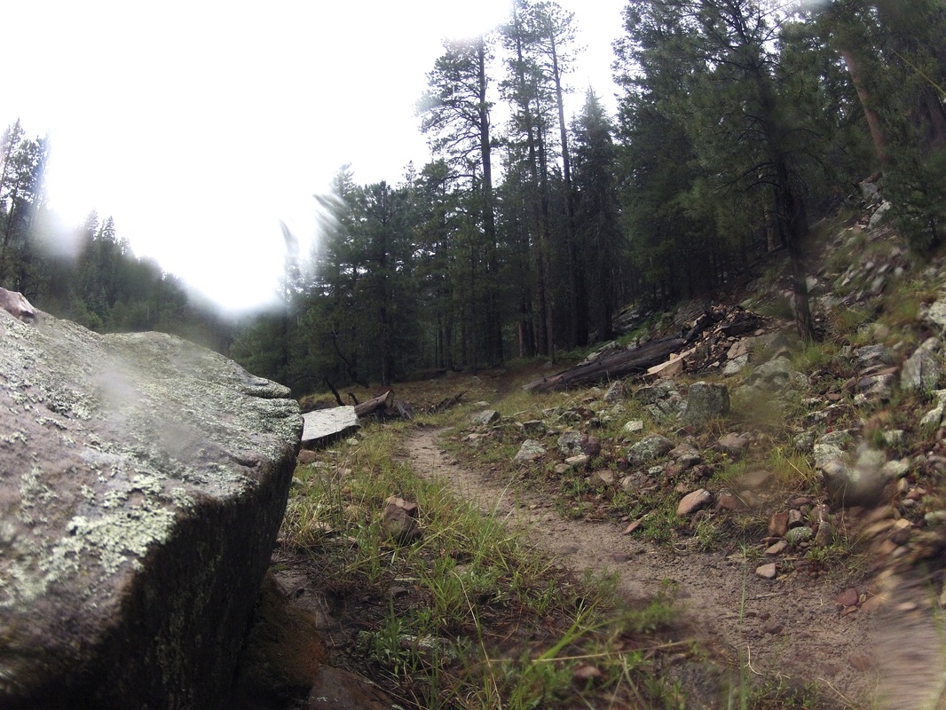
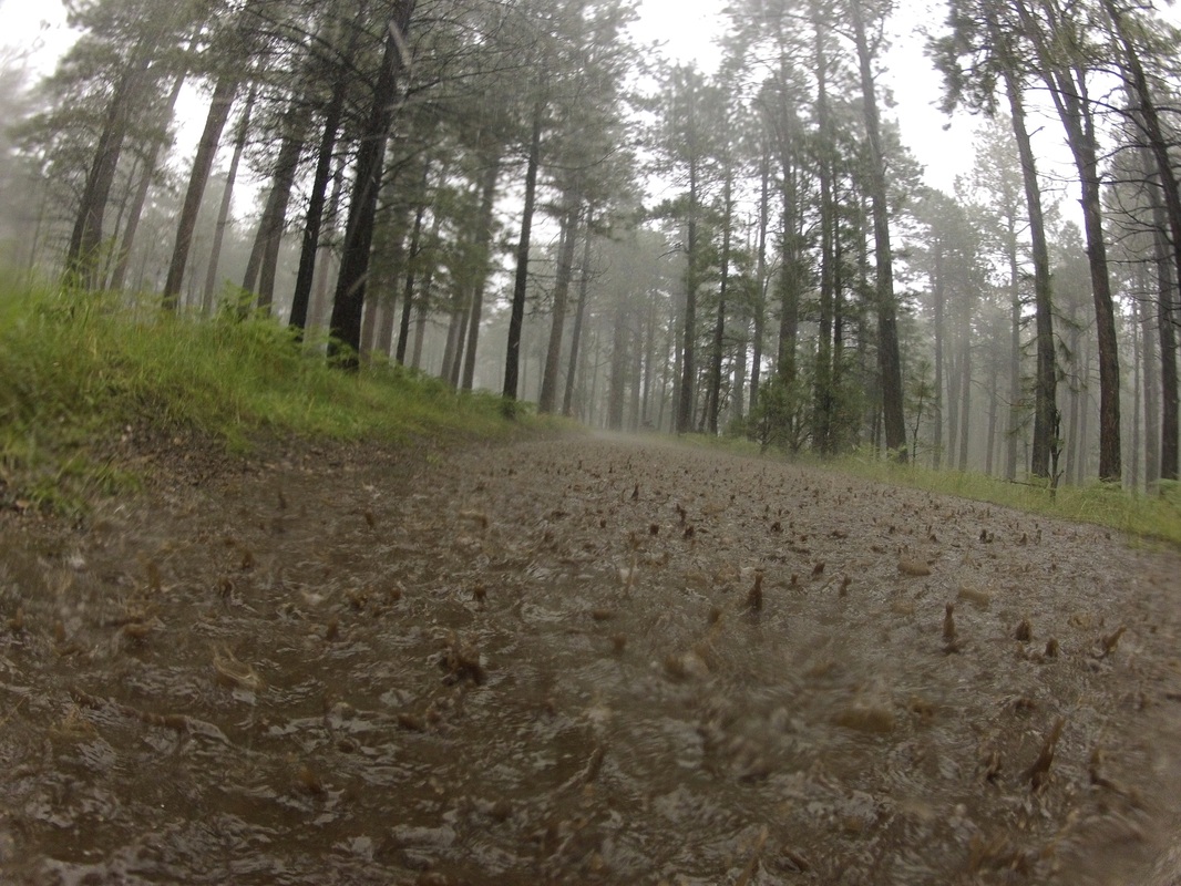
U-Bar Trail - Mile 68ish
This isn't rain. It's skull pounding hail out on the U-Bar trail in mid-August last summer on a training run. It was an exhilarating level of fun and excitement at first but then the lightning felt like it was directly over us and the hail put us under trees for safety until we tried to push on through it. Within fifteen minutes the trail became this road of 6" of water. Rocks the size of softballs were rolling down the hills under the pressure of the sudden flooding. Half a mile later it was sunny...
This isn't rain. It's skull pounding hail out on the U-Bar trail in mid-August last summer on a training run. It was an exhilarating level of fun and excitement at first but then the lightning felt like it was directly over us and the hail put us under trees for safety until we tried to push on through it. Within fifteen minutes the trail became this road of 6" of water. Rocks the size of softballs were rolling down the hills under the pressure of the sudden flooding. Half a mile later it was sunny...
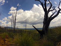
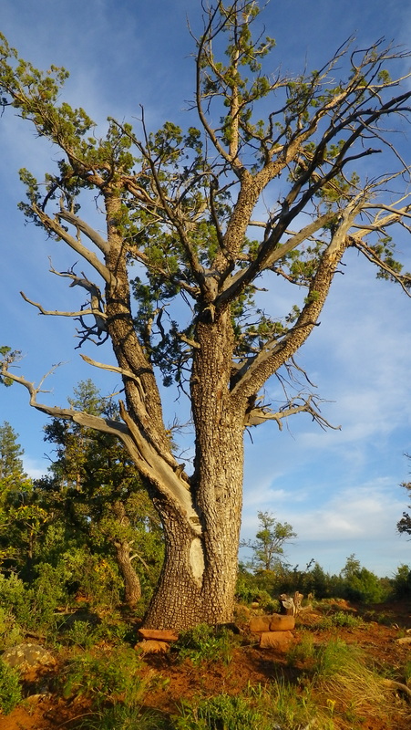
Highline Trail - Mile 22 ish - This is an old Alligator Juniper burned from an old forest fire years ago. Right in the middle of a burn zone the afternoon clouds were starting to rise up in preparation of a storm somewhere along the Rim. I was running this alone, on an out and back of a 22 miler in search of an offshoot trail I read about in an Old West book talking about mining camps. It's up there somewhere, I'll find it eventually. But this shot, this tree shows such a different environment than just a few miles later and certainly the top of the Rim. Such a beautiful contrast.
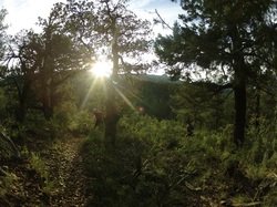
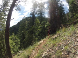
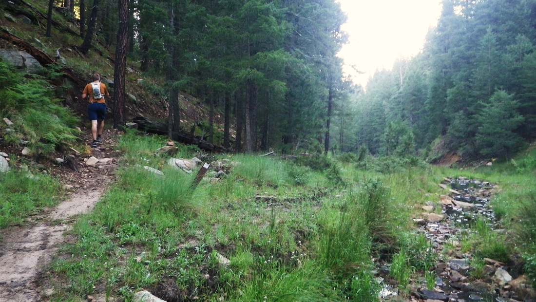
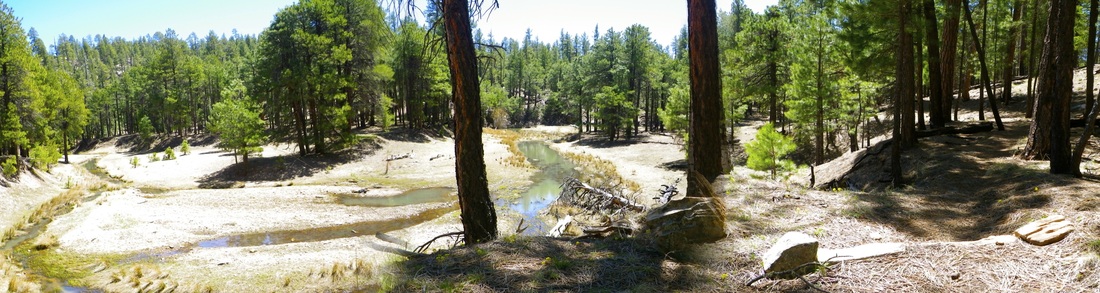
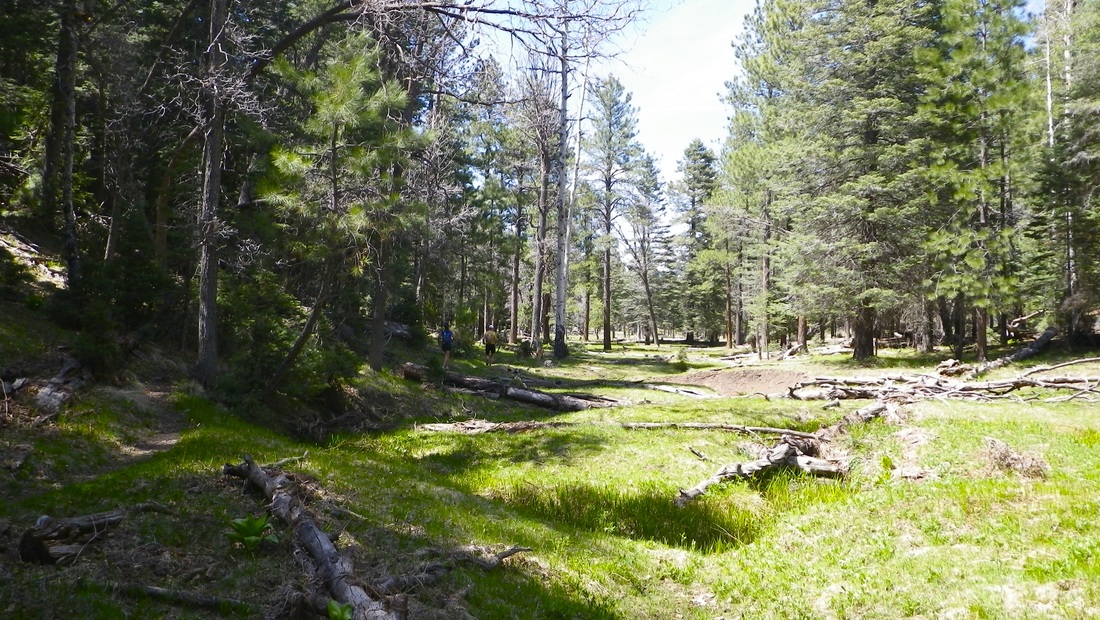
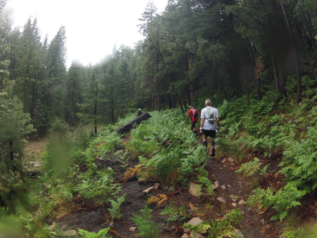
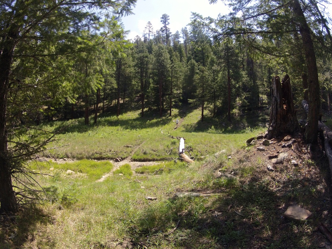
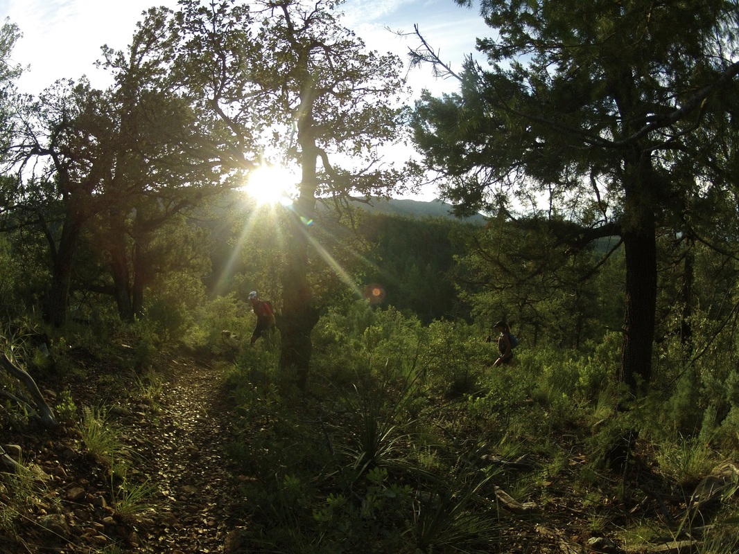
Highline Trail - Mile 55ish - The Honey & Margaret "Let's just wing it up Myrtle Trail" training run that had more adventures in a training run than most I've ever had. We started out at Washington Park and headed towards Hell's Gate. The sun was coming up and starting to peek through the treeline along the Highline. We were headed out on a tough section of the course to see how the conditions were different than when done in April.
As it turns out...pretty grassy...
As it turns out...pretty grassy...
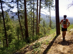
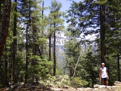
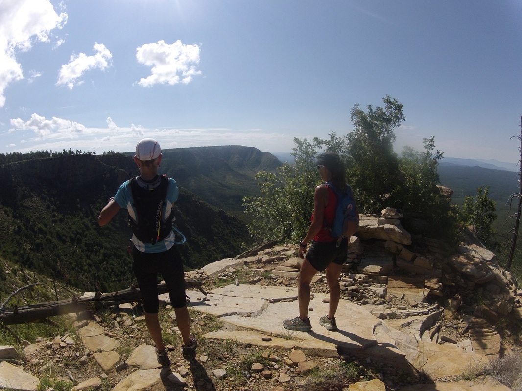
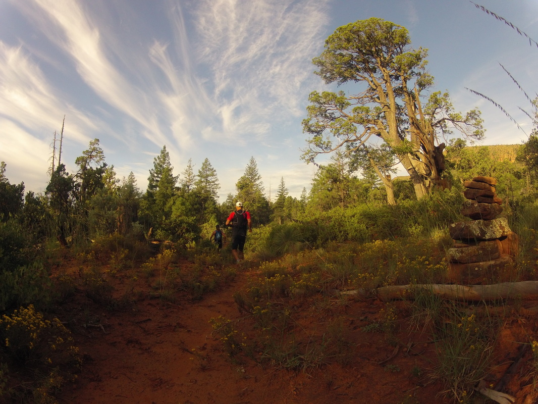
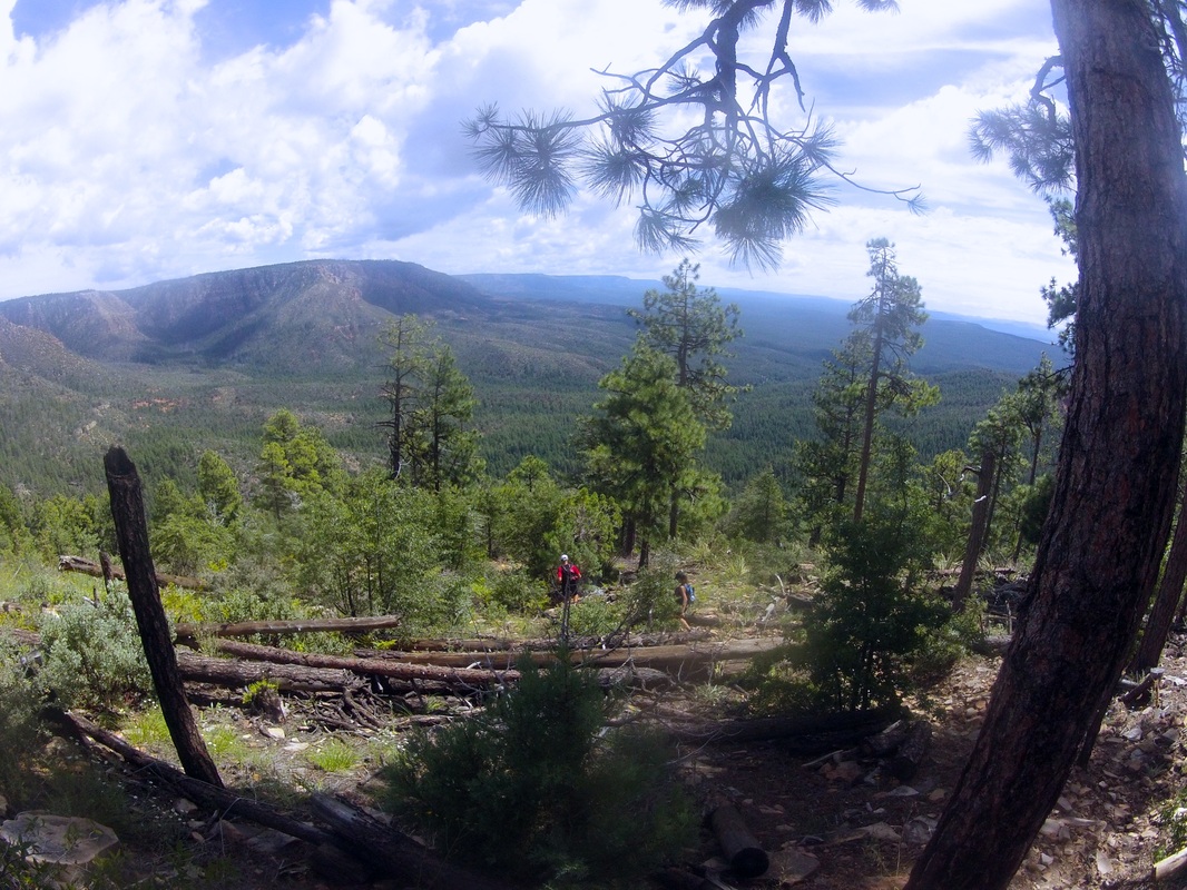
Turkey Springs Trail - Mile 16 ish - I just took this photo on our first training run last month. Geoff Dada was out in front of me on the Turkey Springs Trail which is the first real shot runners get of the Mogollon Rim and it's vastness as it looks out over eastern Arizona. It smoothes out right at this part as you start to drop over 2,000 feet off the Rim and down to the Geronimo Aid Station. The descent is fun to run, but the view stops you again and again.
Myrtle Trail - Mile 60 ish - Standing at the top of the Myrtle Trail is an accomplishment in itself. The trail is a wreck even now after days of trail work to improve it. Its rocky, grassy, downed trees, thorns and more elk trails leading you off in the wrong direction...it's just a nightmare to navigate without ribbons.
With ribbons it's not easy either. No matter what, standing on these rocks as you pull through the last switchback is an accomplishment and a relief. It'll be dark for most runners but the moon casts a long shadow out here, and when it's full, you can see the Rim like never before from this very spot. In my test run of the course last May I stood at this spot 60 miles in under a Super Moon.
Incredible.

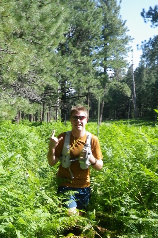
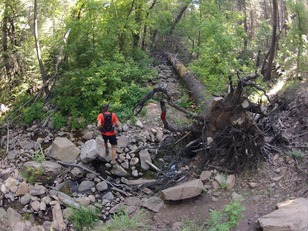
Houston Brothers Trail - Mile 73 - Our very first training run and my first time I'd ever run the Cabin Loop. I shot this in August 2011 over my shoulder and my brother Noah saw me throw the camera up and this is what came out. It really captures the day we had out there, just two guys having an absolute blast on a trail that was so much fun to run. It was such an early moment out on the trails up there looking back now this picture is really the start of it all for Noah and I. We'd been on a lot of the other parts of the course but not the Cabin Loop. It was like discovering a bag of gold sitting in your garage all these years.
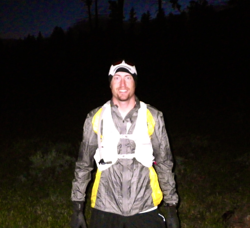
Pine Trailhead - Mile 0
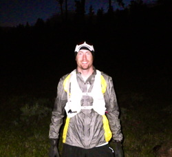
May 5th, 2012. This is me just before heading out for a self supported shot at the full 106 miles. We pulled into the parking lot that morning to find a herd of elk taking up real estate right at the start and then Jay Danek and I headed off into the darkness to what would be a 26+ hour adventure for me. I'd call it a day back at Washington Park mile 86 with a bad ankle and having to work the next day but it was an incredible experience that to me is wrapped up in this one picture.
May 5th, 2012. This is me just before heading out for a self supported shot at the full 106 miles. We pulled into the parking lot that morning to find a herd of elk taking up real estate right at the start and then Jay Danek and I headed off into the darkness to what would be a 26+ hour adventure for me. I'd call it a day back at Washington Park mile 86 with a bad ankle and having to work the next day but it was an incredible experience that to me is wrapped up in this one picture.
Highline Trail - Mile 54/55
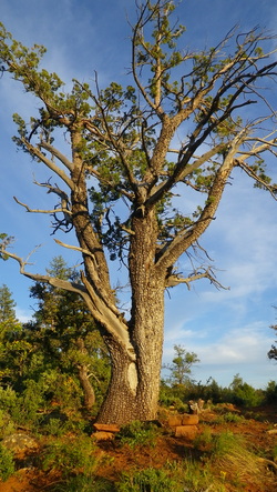
This is an alligator juniper tree out on the Highline on your way to Hell's Gate AS. There are plenty of them out there, mostly along the Highline Trail. Very distinct in their bark, you'll know exactly what it is when you see it. I love them.
This is an alligator juniper tree out on the Highline on your way to Hell's Gate AS. There are plenty of them out there, mostly along the Highline Trail. Very distinct in their bark, you'll know exactly what it is when you see it. I love them.

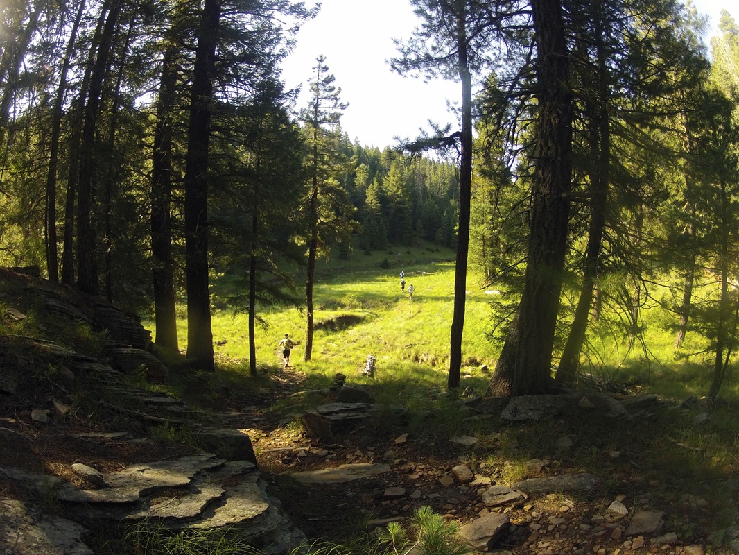
Fred Haught Trail - Mile 42/44 ish
After your first trip through Pinchot Cabin AS you'll leave Bear Canyon and start down Fred Haught Trail. It's a beautiful part of the Cabin Loop and one that from this vantage point you catch other runners off down the small valley. We were almost halfway through our May 5th trial run at this point and I was feeling great, strong and ready to take on the second half.
After your first trip through Pinchot Cabin AS you'll leave Bear Canyon and start down Fred Haught Trail. It's a beautiful part of the Cabin Loop and one that from this vantage point you catch other runners off down the small valley. We were almost halfway through our May 5th trial run at this point and I was feeling great, strong and ready to take on the second half.
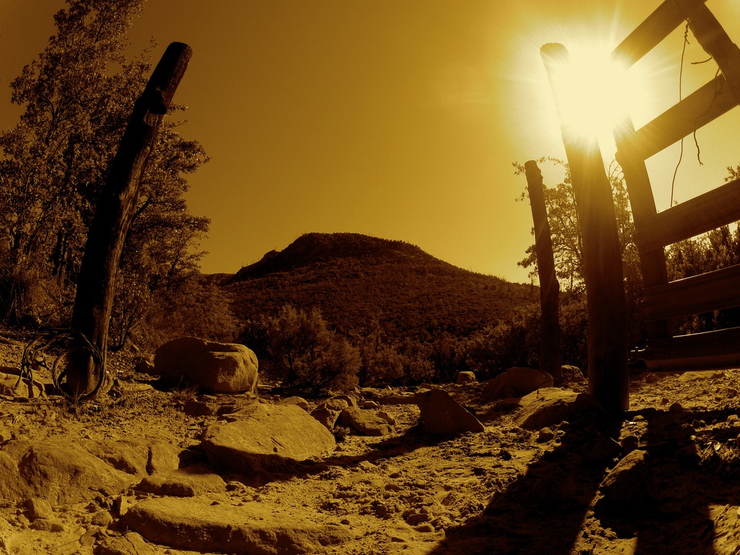
Pine Trailhead - Mile 0/104
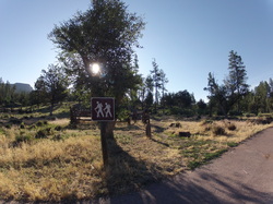
It's both the start and also the final aid station of the race. You'll kick off the race here, as does Zane Grey 50M, and after coming down off Donahue Trail you'll come through here before the last stretch into Pine. It's a memorable parking lot, the start of so many adventures over the years. Just a few feet from here we kicked off last years inaugural race.
It's both the start and also the final aid station of the race. You'll kick off the race here, as does Zane Grey 50M, and after coming down off Donahue Trail you'll come through here before the last stretch into Pine. It's a memorable parking lot, the start of so many adventures over the years. Just a few feet from here we kicked off last years inaugural race.
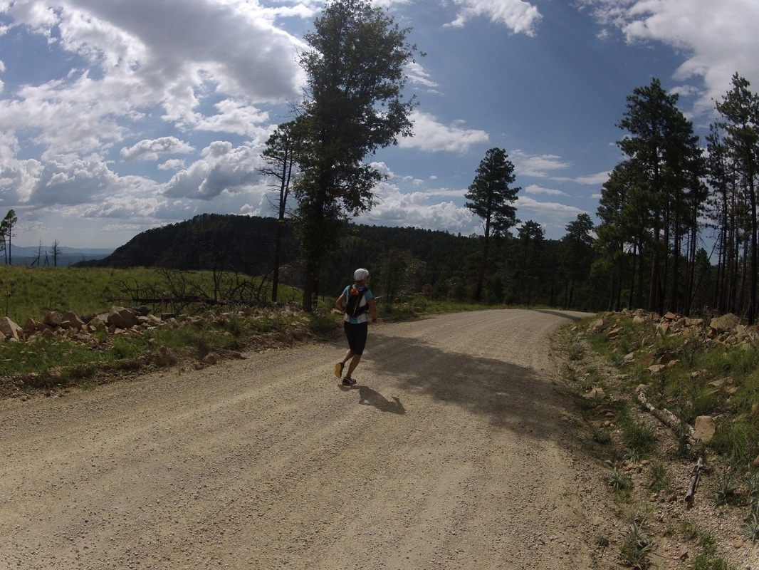
Rim Road #300 - Mile 33ish
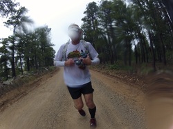
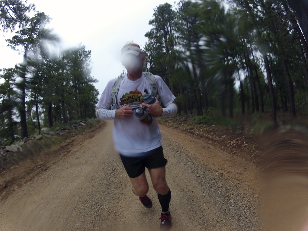
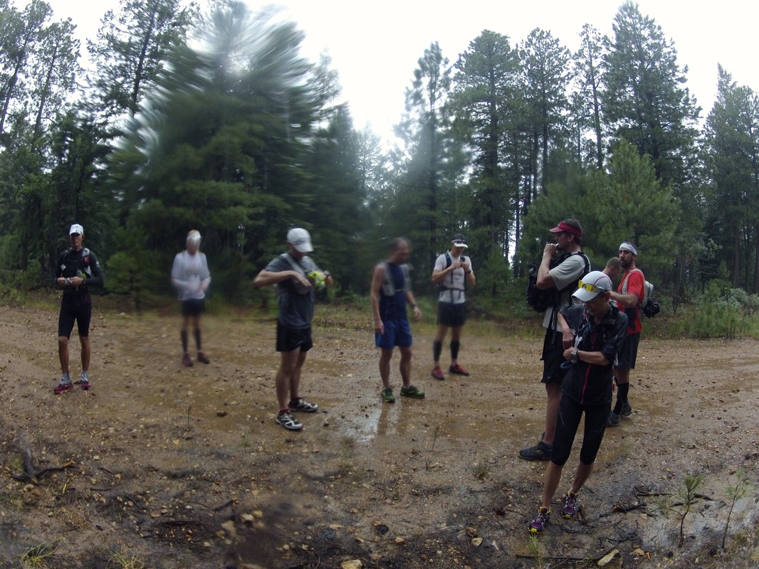
John Vaupel along the Rim Road on a day where it poured the entire group run. From start to finish, it rained. It was one of those days that nobody cared, we're almost all from the desert, we love rain. But there was such a jovial spirit from everyone, nobody bitched and it felt like it was a group of 12 year old's out splashing through mud puddles. Just one of those "this is why we run" type of days.
John Vaupel along the Rim Road on a day where it poured the entire group run. From start to finish, it rained. It was one of those days that nobody cared, we're almost all from the desert, we love rain. But there was such a jovial spirit from everyone, nobody bitched and it felt like it was a group of 12 year old's out splashing through mud puddles. Just one of those "this is why we run" type of days.

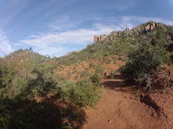
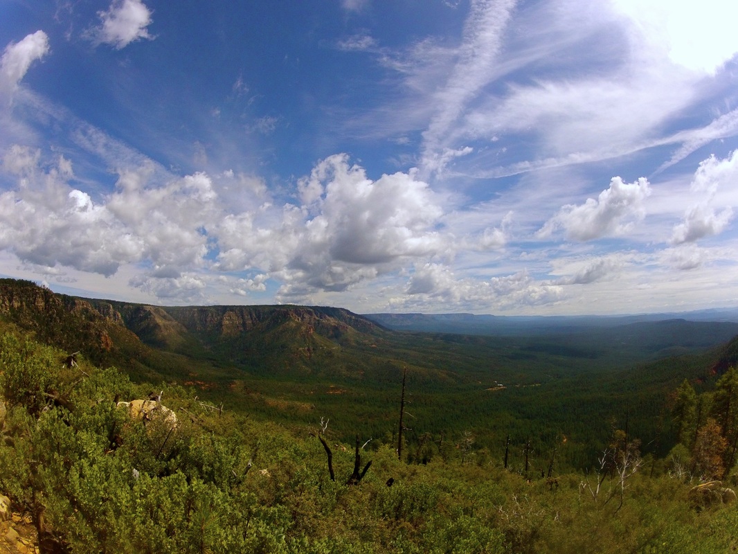
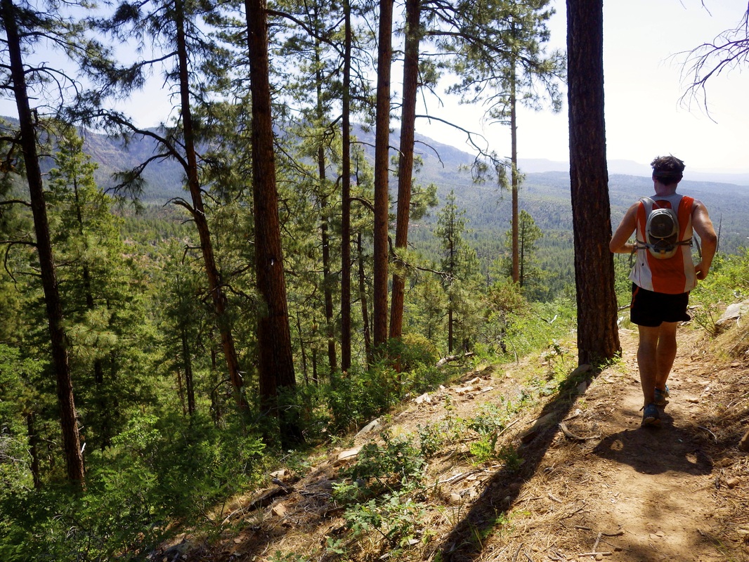
Turkey Springs Trail - Mile 14
Just as you start to drop out of the forest and onto Turkey Springs Trail you catch a full glimpse of the Mogollon Rim. Runners down below on the switchbacks are of little care at this moment. Simply beautiful.
Just as you start to drop out of the forest and onto Turkey Springs Trail you catch a full glimpse of the Mogollon Rim. Runners down below on the switchbacks are of little care at this moment. Simply beautiful.

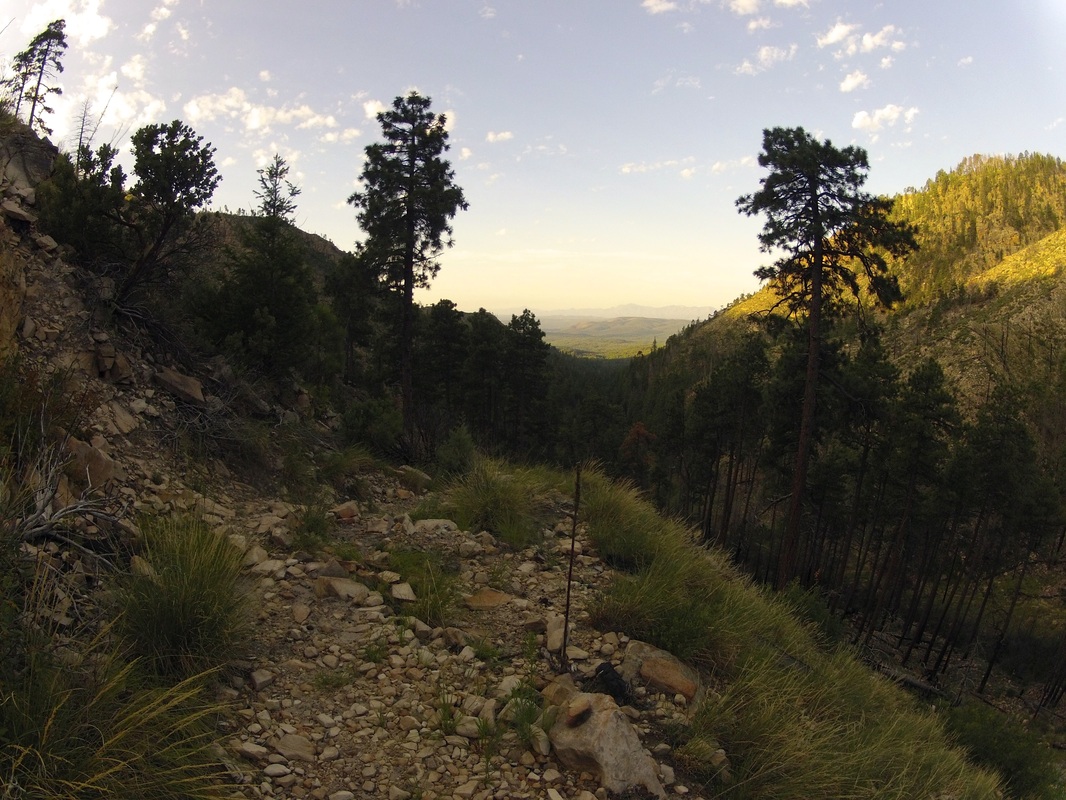
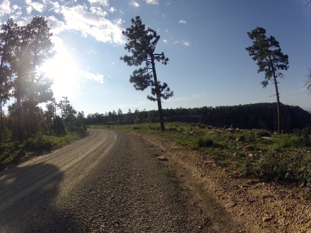
Rim Road #300 - Mile 30ish
The Rim Road #300 travels for 50 miles east to west across the edge of the Mogollon Rim. It's one of the most beautiful drives in Arizona constantly weaving in and out of the forest and into picturesque and genuinely epic dropoff's looking far down below. This is some of the brief stretches of forest road running in the race, a 4.5 mile stretch to the entrance to Houston Brothers Trail. Most runners will catch this in the late afternoon/early evening and maybe even snag a beautiful sunset in the process. I'm not a fan of road running but I don't mind this stretch at all.
The Rim Road #300 travels for 50 miles east to west across the edge of the Mogollon Rim. It's one of the most beautiful drives in Arizona constantly weaving in and out of the forest and into picturesque and genuinely epic dropoff's looking far down below. This is some of the brief stretches of forest road running in the race, a 4.5 mile stretch to the entrance to Houston Brothers Trail. Most runners will catch this in the late afternoon/early evening and maybe even snag a beautiful sunset in the process. I'm not a fan of road running but I don't mind this stretch at all.

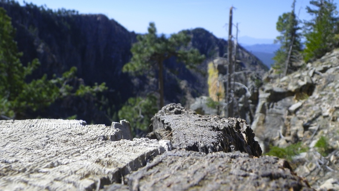
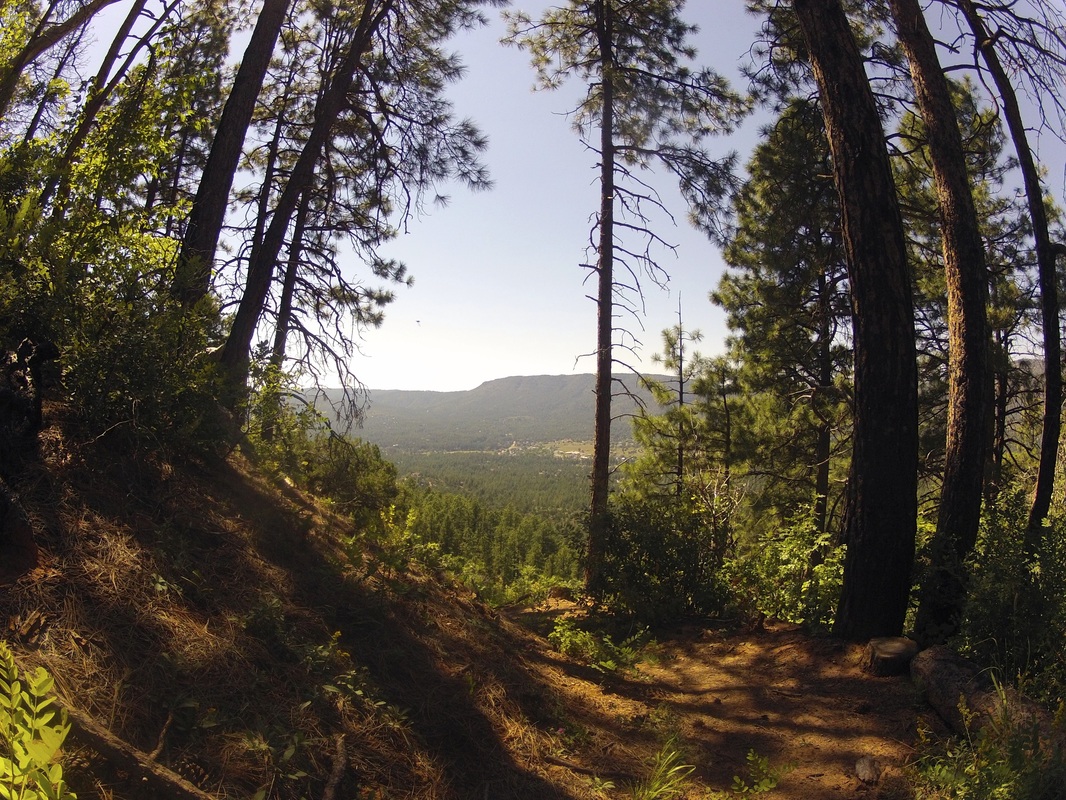
Turkey Springs Trail - Mile 15
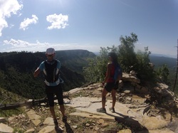
This is it. A shot from the top of a tree stump after navigating the Guantlet of the first .5 miles down Turkey Springs Trail. It opens up to this view of the Mogollon Rim and I've yet to not stop and just stare as I come down off the cliff. Simply incredible and every time...just a little bit different than the last.
This is it. A shot from the top of a tree stump after navigating the Guantlet of the first .5 miles down Turkey Springs Trail. It opens up to this view of the Mogollon Rim and I've yet to not stop and just stare as I come down off the cliff. Simply incredible and every time...just a little bit different than the last.

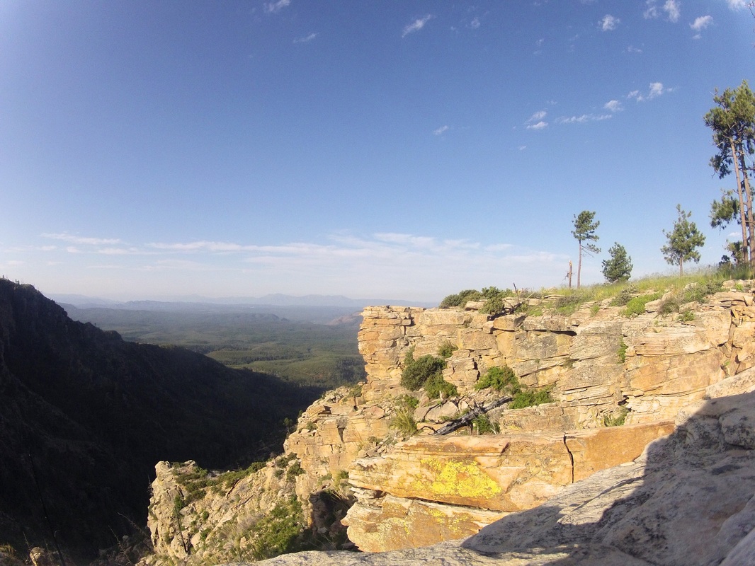
Rim Road #300 - Mile 33ish
Right off the road itself before reaching Houston Brothers Trail you skirt the edge of the Rim and you get a really intimate feel for how jagged and rugged the nature of the Rim really is. In the coming sunrise it's only magnified as the day progresses.
Right off the road itself before reaching Houston Brothers Trail you skirt the edge of the Rim and you get a really intimate feel for how jagged and rugged the nature of the Rim really is. In the coming sunrise it's only magnified as the day progresses.
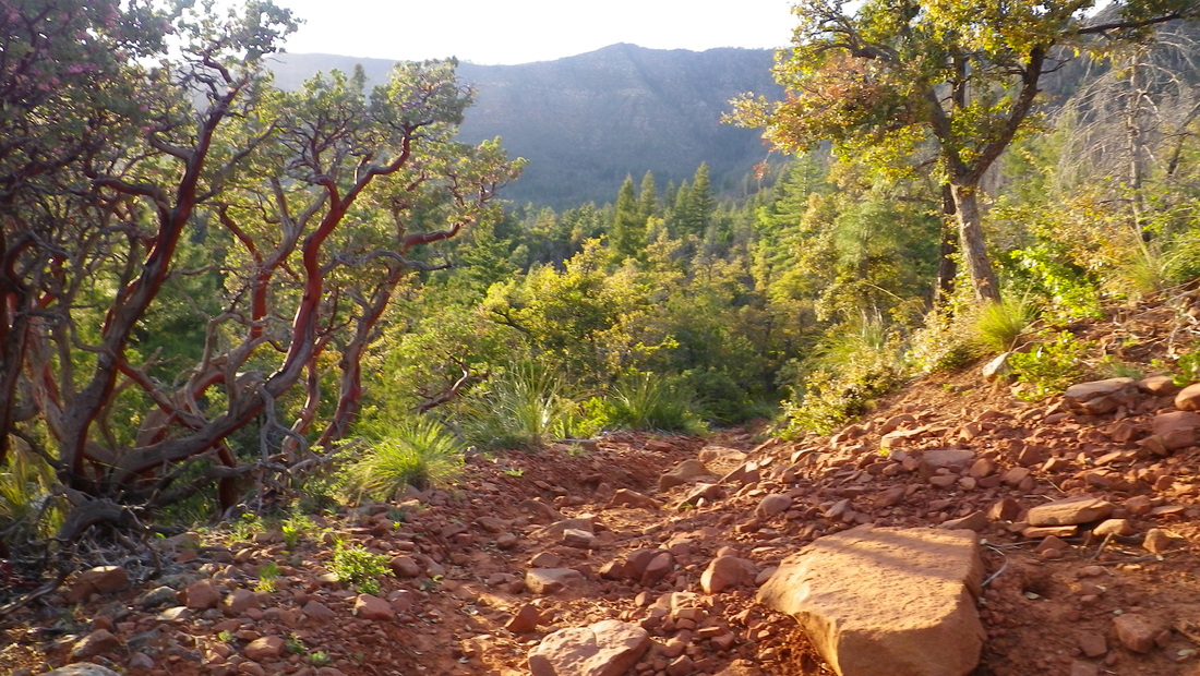
Highline Trail - Mile 93 ish
Coming back towards Geronimo Aid Station after leaving Washington Park for the final time you hit a stretch of red rock along the Highline Trail. The Highline doens't ever come close to disappointing on its raw and natural beauty. This picture doesn't do the trail justice but you'll understand when you get there.
Coming back towards Geronimo Aid Station after leaving Washington Park for the final time you hit a stretch of red rock along the Highline Trail. The Highline doens't ever come close to disappointing on its raw and natural beauty. This picture doesn't do the trail justice but you'll understand when you get there.
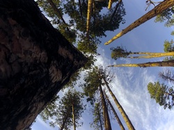
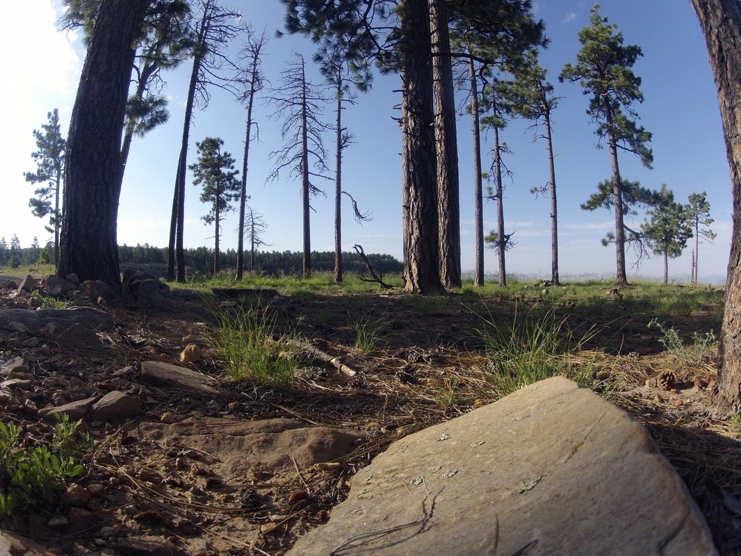
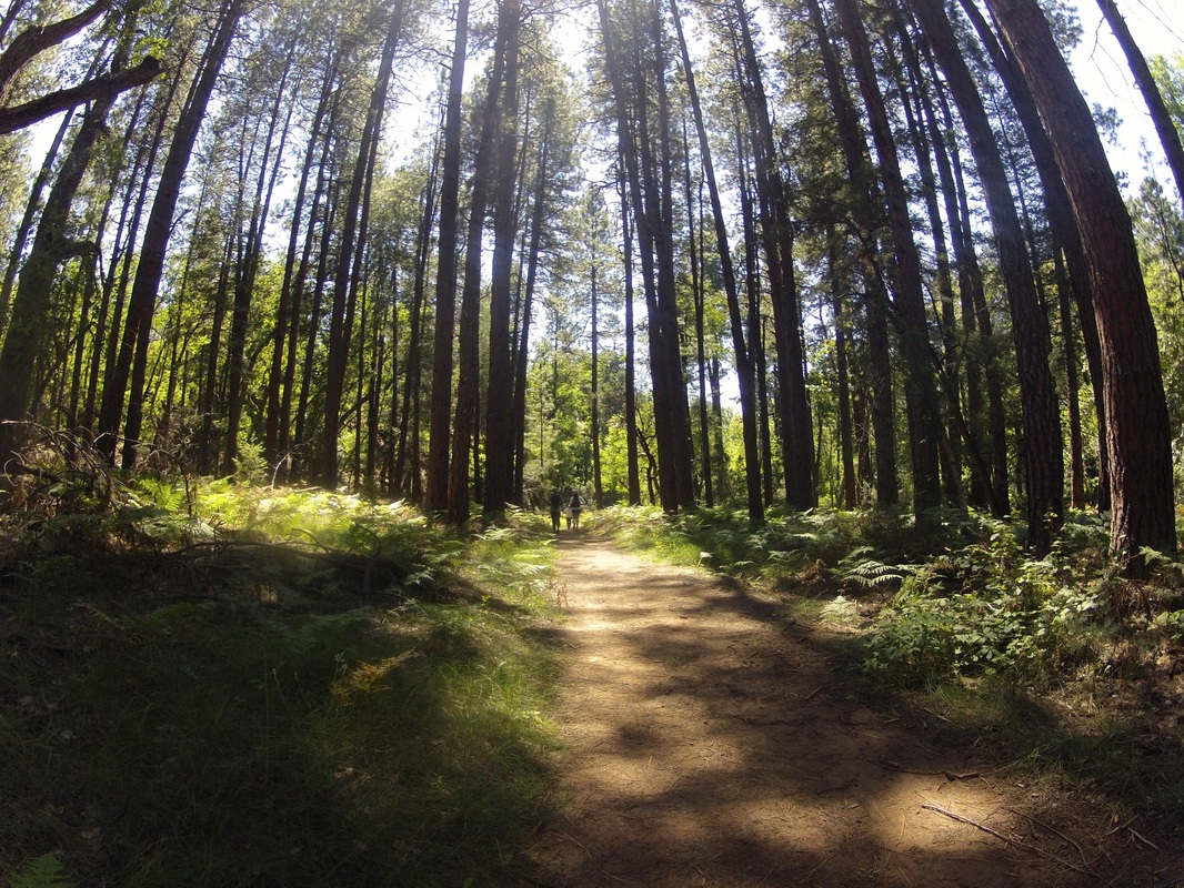
Ponderosa Pine Trees - Everywhere
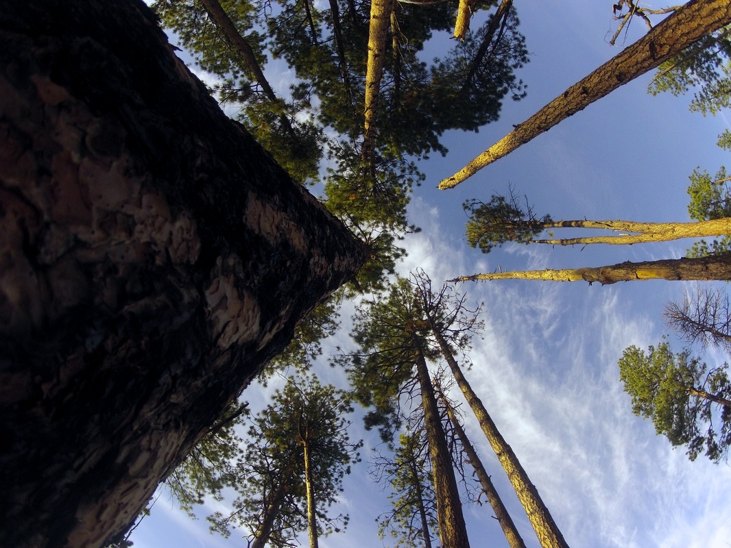
The Ponderosa is as symbolic of the area as the Saguaro Cactus is to the deserts of Arizona. Hundreds of years old they are incredible trees and beautiful spread throughout the top of the Rim, scattered about to create a very minimal canopy that allows the light to shine through to the floor below. They symbolize everything that is above the Rim.
If you get bored out there stop and smell the cracks in the bark.

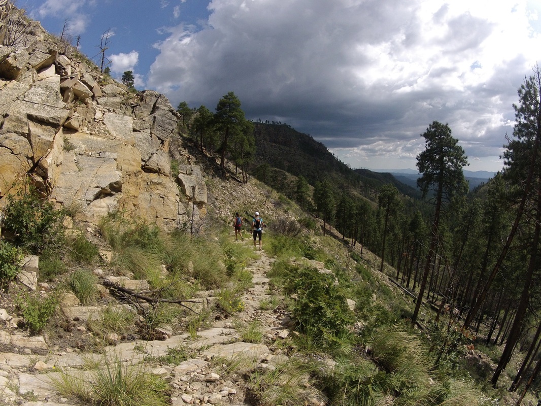
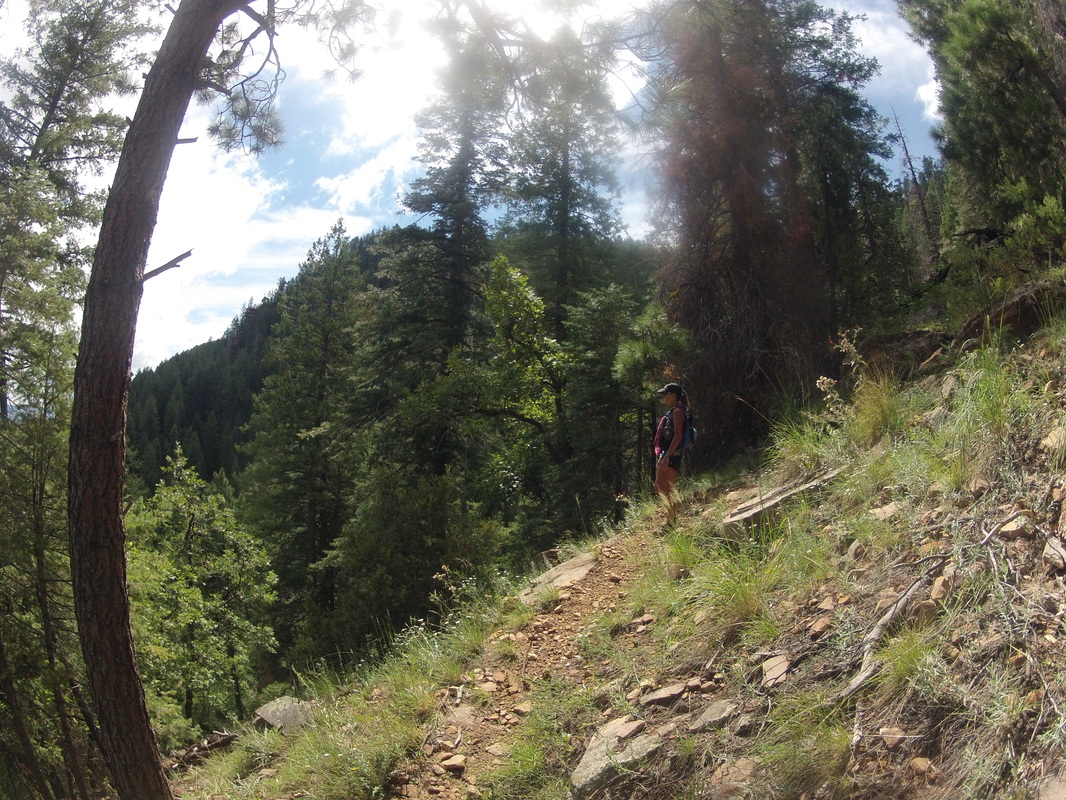
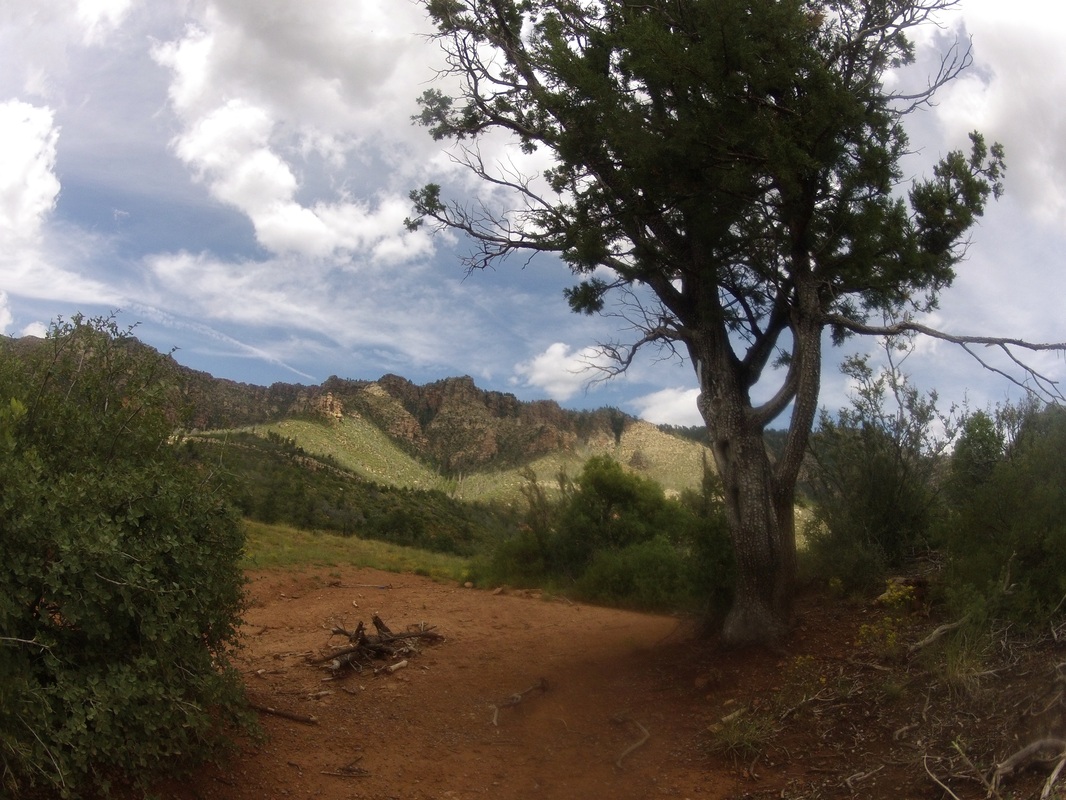
Highline Trail - Mile 21
Another stretch along the Highline after the couple miles of climbing out of Geronimo Aid station. The trail has been re-routed at this exactly point by the tree to a much better stretch of runnable terrain. This point in the Highline though gets you out and up to the elevation you'll stay at for a great deal of the mileage, just a constant up and down from here with the clouds billowing above you casting massive shadows over pieces of the valley below.
Another stretch along the Highline after the couple miles of climbing out of Geronimo Aid station. The trail has been re-routed at this exactly point by the tree to a much better stretch of runnable terrain. This point in the Highline though gets you out and up to the elevation you'll stay at for a great deal of the mileage, just a constant up and down from here with the clouds billowing above you casting massive shadows over pieces of the valley below.
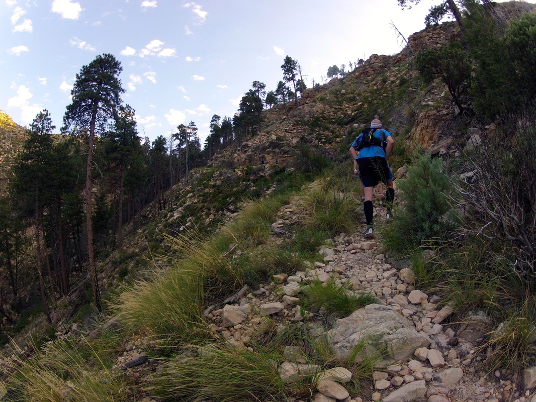
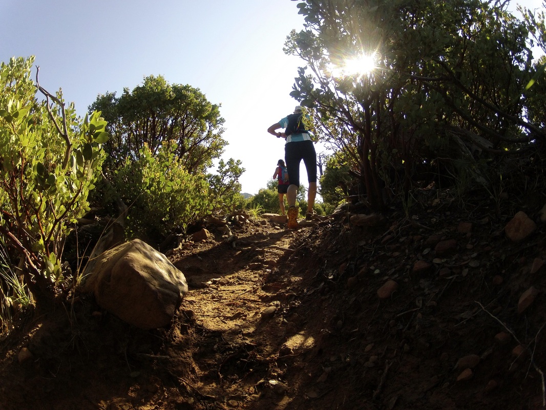
West Webber Trail - Mile 99
Mile 99 you start a 1,008 foot climb to the top of the Rim. It's a dickknocker of a climb, just relentless in nature at such a vulnerable time in the race. But that's the way it goes and along the way, you'll catch yourself stopping to look back and see the pure accomplishment of your race. Far below was Geronimo AS and just above is mile 100...and the remainder of the race all being downhill..
Mile 99 you start a 1,008 foot climb to the top of the Rim. It's a dickknocker of a climb, just relentless in nature at such a vulnerable time in the race. But that's the way it goes and along the way, you'll catch yourself stopping to look back and see the pure accomplishment of your race. Far below was Geronimo AS and just above is mile 100...and the remainder of the race all being downhill..
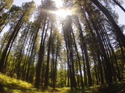
Pine Canyon Trail - Mile 5
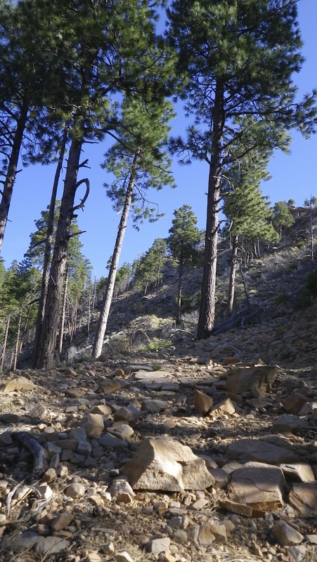
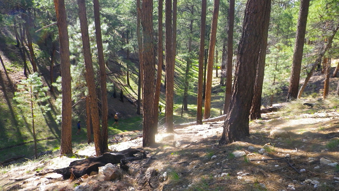
Starting out in the race you run through different terrain in just a few miles. High desert, red rocks and then you hang a right turn in the forest and start running through a forest as you climb up Pine Canyon to the first aid station. It's not an easy section, it's actually a heck of a start those first 8 miles, but the beauty of these miles makes up for it as you climb mile after mile up this forest trail to your first trip atop the Rim.
Starting out in the race you run through different terrain in just a few miles. High desert, red rocks and then you hang a right turn in the forest and start running through a forest as you climb up Pine Canyon to the first aid station. It's not an easy section, it's actually a heck of a start those first 8 miles, but the beauty of these miles makes up for it as you climb mile after mile up this forest trail to your first trip atop the Rim.
West Webber Trail - Mile 99.8
Coming out of this turn to this point is a wonderful moment. You have just a few jogs to the forest road where you'll hit 100.0 miles. You're not done of course but the mental state of knowing you're done with the climbs is a powerful one.
The barn door is there. You can smell it from this very point.

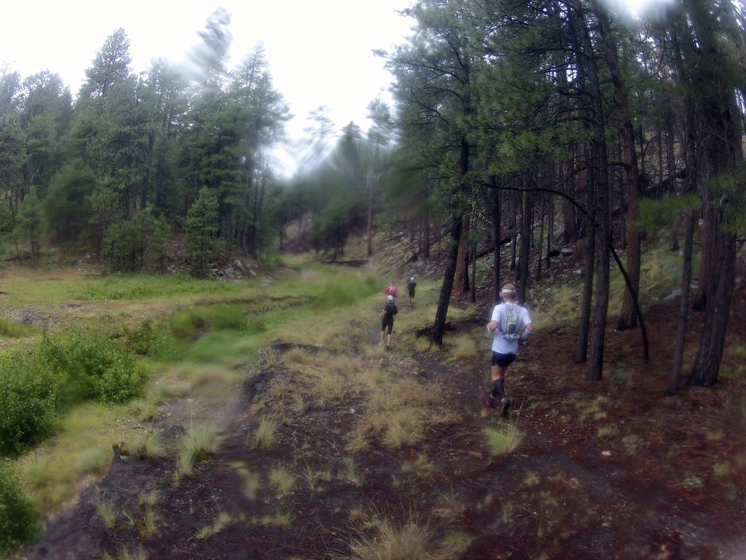
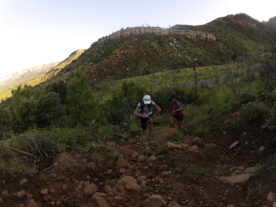
Arizona Trail - Mile 51
This is the 2 mile stretch between Washington Park and the top of the Rim. You'll climb this at 26, drop down at 51 and then again drop down it at 84.
It's not easy.
It's not smooth.
It's actually pretty damn hard. But it's a beautiful downhill and after the first third of the steep mountain goat part you can really let it loose all the way into the aid station. On this day the clouds were rolling in, we'd been buried in a hail storm, lost on Myrtle Trail and all in all had a hell of a day. This was our final 2 miles and we made the most of it.


 RSS Feed