cabin_loop_50k.pdf |
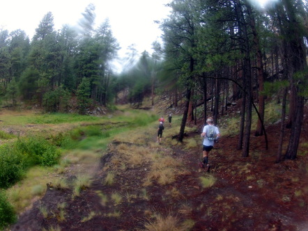
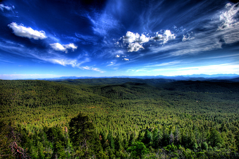
Section of the Fred Haught Trail/Arizona Trail during the July 14th Training Run This Saturday I'm heading up to finalize a few sections of trail along the U-Bar trail on the Cabin Loop section of the course and plan on running what will be about 50K starting at the Washington Park Trailhead. I'll be leaving Phoenix at 4am Saturday and starting at 6am from Washington Park. The route will be a climb up the Rim on the Arizona Trail, 4.5 miles east along the Rim Road and entering the Cabin Loop at Houston Brothers. We'll divert across the Barbershop Trail (not a part of the course but a great trail) to the start of the U-Bar Trail. We'll head north from there up and down the canyons and then reaching Pinchot Cabin we'll take Fred Haught Trail all the way back down to Washington Park. Low point of this section is 5,800 feet and gets a little over 7,900. Has right at 5,000 feet of climbing. I have a PDF of the course map below you can download for a topo of the course. Email me at azadventures@getoutgetlost.com if you are interested and want to carpool or just want to make sure we wait for you at the trailhead! We'll have more training runs later in August as well that I will put out with more notice for everyone. This trip is open to everyone and has a goal of determining where the U-Bar trail needs additional marking as we struggled to follow it in the dark back in May. We obviously want to avoid that come race day so we're going up to run it in the day and see how it looks
0 Comments
I completed a spreadsheet of all the aid station splits, where crew access is available, pacers can jump in and what the cutoffs are for each aid station. Starting at 10am Friday runners will have 36 hours or 10pm Saturday to complete the race. I think this is a fair cutoff and the below individual times are as fair as I can tell. You can also see the cumulative gain and loss for each section and the accumulative number as you go. For the first 50 miles there is around 9,000 feet of climbing. The remaining 56 miles has about 10,000 feet of climbing. I've mapped this course about four times now on different programs and it's right around the 18,500 - 19,200 feet in climbing each time and right around 105.5-106.4 miles. Keep in mind your Garmin stats are always going to differ and exact mileage is difficult to determine on such rugged terrain. They generally match up very closely with what I have had come up on my Garmin running these sections so I'm comfortable releasing these numbers. I'll also have at each aid station a quick reference sheet on the way out of each station for information on the next section so you always have a nice reminder. For example: Leaving Dickerson Flat aid station I'll have a sign that reads, "Next Aid Station- Geronimo Aid Station - 4.96 miles - 588ft of climbing, 2414ft descending down Turkey Springs Trail" Or something to that affect. While I expect our volunteers to know the course to provide directions I also know that doesn't always happen at races and this keeps the guess work out of it and everyone on the same page. And for those times that you might need to mentally gear up for a big climb you'll at least know what you're getting into for the next section.
Almost...On May 5th I attempted to run the full course from start to finish. I wrote a recap of the self supported attempt on my blog at www.getougetlost.com. It has more pictures, descriptions of what you can expect. Worth the read if you are running the race given there is no race report for this event being in its first year!
Here's a video of the course from miles 24-46 on the climb up the Rim and around the first series of trails in the Cabin Loop. Still fresh off winter snows so the area hasn't had a chance to grow the meadows and flowers yet but still very pretty and great running.
Something I've heard since the idea first came about to start a new 100 mile wilderness race in Arizona, from scratch, is the concerns of some that they "don't run first year races."
I can certainly understand the concern and I've made every attempt in working with other race directors in learning the challenges they face in hopes of working contingencies out in advance, planning as meticulously as possible to avoid many of those "first year" miscues people may be fearing. So in an effort to further dispel those fears I have joined up with ATRA and Goodpeoplerun.com in their mission to provide a 15 step series of standards for all trail running events. ATRA, American Trail Running Association (found at www.trailrunner.com) really wants to make this the gold standard so to speak in providing runners with a race where you know the expectations are met across the board from course marking, safety, preparation and many other steps. Many of these steps are what you find at any well organized ultra but some certainly are missed at others. Here are the 15 standards, I encourage you to take a look and check out www.trailrunner.com for ongoing updates for the trail and ultra community. The North Face has approved the Mogollon Monster 100 for 4 points towards qualifying towards their series in 2013. Very exciting to have that designation in the first year and proud to display their logo for the race. With Western States 100 and Hardrock 100 being races that require your first year to be complete it'll be a few more years before we have full designation as a qualifying race for the other "Big One's" but exciting nonetheless.
Here's the current list of qualifying races for UTMB, CCC and others: http://www.ultratrailmb.com/page/87/courses_qualificatives_liste.html ULTRAmarathonrunning.comThe Mogollon Monster 100 is now listed on several race calendars, including the largest list internationally,ULTRAmarathonRunning.com. http://www.ultramarathonrunning.com/races/mogollonmonster100.html We're also in Trail Runner Magazine's December race calendar issue that should be in the mail in the coming weeks. Really great to see the interest in the race outside of the local communities excitement. First Running of the Mogollon Monster 100Two weeks from tomorrow a half dozen intrepid ultrarunners are joining me in a 106 mile journey across the Mogollon Monster 100 race course. Very limited support but the plan is to run the entire course, as you runners will experience it. Having run all sections at different times it is excited to see how all the course will flow, and wind it's way into what will become, The Mogollon Monster 100. We are doing it in December, only 11 days from the Winter Solstice so our daylight is going to be minimal. It's going to be much colder than the actual race date with expected lows on the Rim in the teens,hopefully without any snowfall. We expect a steady flow of updated information,pictures and maybe even some footage of the actual Mogollon Monster by the end of the whole ordeal. It's out there somewhere... RegistrationRegistration is expected to open sometime in December or on January 1st,2012. We are just waiting on final,final approval on a specific part of the course from one of the two National Forests the course travels through. Once approval is officially granted we will have registration linked on ultrasignup.com. Stay tuned, and keep checking back!
I came across a couple great photos of the Mogollon Rim area taken by Arizonasteve.com. This is a great representation of the view from many parts of the Mogollon Monster 100 course.
This blog will be used to update the course conditions, training run opportunities, needs for volunteers and various updates as we get closer to the race itself. Please subscribe to the RSS Feed to the right for updates or check back soon!
|
Archives
May 2022
Categories
All
|